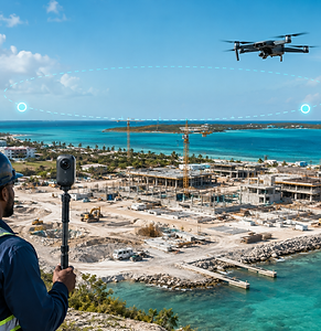
.png)

See the Entire Project
From the Ground to the Sky
Transform your construction site into a clear, measurable visual record. Zann Industries combines detailed ground-level documentation with aerial drone mapping to help project teams monitor progress, improve coordination and keep stakeholders informed—wherever they are located.
A Clearer View of Construction Progress
Managing a construction project requires more than occasional photographs and written updates. Project owners, contractors, and consultants need reliable visual information that shows what has been completed, what has changed, and where attention may be required.
Our aerial and ground mapping services create an organized visual record of your project.
From detailed ground-level walkthroughs to comprehensive aerial site views, your team gains the information needed to review progress, coordinate work and make better-informed decisions.
Whether your project is in Nassau, on a Family Island, or on a remote cay, Zann Industries helps bring the site directly to your team.

Ground-Level Site Documentation
Capture detailed, location-based imagery throughout the construction site. Ground documentation allows project teams to review specific areas, track visible changes, and maintain a dependable record of site conditions over time.
Key features:
• Detailed interior and exterior site captures
• Organized visual walkthroughs
• Progress documentation by location
• Remote access for authorized stakeholders
• Historical comparisons between site visits
• Visual records for reporting and coordination
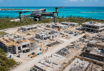
Aerial Drone Mapping
Gain a comprehensive view of the entire project using high-resolution aerial imagery. Drone mapping helps teams understand site conditions, monitor large work areas and document progress from perspectives that cannot be achieved at ground level.
Key features:
• High-resolution aerial photography
• Construction progress overviews
• Orthomosaic site maps
• Site-condition documentation
• Progress comparisons over time
• Visual support for planning and reporting

Turn Site Data Into Better Project Decisions
Our aerial and ground documentation services provide project teams with an organized visual record of site conditions and construction progress. Each service can be customized around the size, duration, and reporting requirements of your project.
Visual Site Walkthroughs
Aerial Progress Imagery

Orthomosaic Maps


Progress Comparisons

Remote Stakeholder Access

Organized Project Records
From improving coordination to reducing unnecessary site visits, your team receives clearer information for monitoring progress, preparing reports, and making informed decisions.

More Than a Mapping Service
Zann Industries combines scheduled aerial and ground documentation with continuous Surveil360 monitoring and construction-site connectivity. This gives project teams a more complete view of activity before, during, and between scheduled site captures.
Our team can develop a customized documentation schedule based on project milestones, weekly reporting requirements or monthly progress reviews. Services are available for projects in Nassau, the Family Islands and remote cays.